Sedona Landmarks: Getting OrientedThe reference point for all Sedona locations is "The Y", which is what everybody calls the intersection of highways 89A and 179:
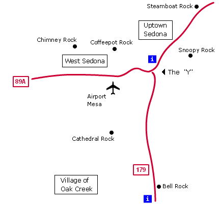
The place to see most of these landmarks is at the "mini" Airport Mesa.
|
|
Sedona Landmarks: Getting OrientedThe reference point for all Sedona locations is "The Y", which is what everybody calls the intersection of highways 89A and 179:
The place to see most of these landmarks is at the "mini" Airport Mesa.
|
|