Sugarloaf / Thunder Mountain
This relatively flat trail system is designed for an easy scenic wandering in the red rock hills above West Sedona.
You can head west to Chimney Rock, east to Coffeepot Rock, or climb Sugarloaf for views.
| Trailhead: |
From the 89A / 179 "Y" ... take 89A west 2.0 miles;
turn right on Coffeepot Drive for 0.6 miles;
turn left on Sanborn for 0.2 miles;
turn right on Little Elf Drive and follow trailhead signs;
parking lot is on your left. |
| Length: |
Open-ended Elevation change: 200 ft |
| Notes: |
(1) There is a confusing tangle of paths at the trailhead; the official trail is on the right.
(2) Sugarloaf Loop is much easier to follow if you do it counterclockwise. |

The Hike

Chimney Rock
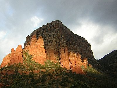
Thunder Mountain (a.k.a. Capitol Butte)


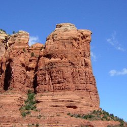
Coffeepot Rock

This is a good trail at sunset, which is also a good time to spot
rabbits, quail, and well-fed coyotes...
|

home |
hikes |
parking |
weather
|


